 |
|
 |
 |
 |
 |
 |
 |
|
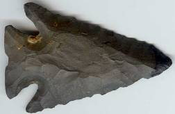
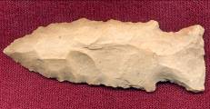
Lost Lake Associated Dates: 10000 - 8000 Y.B.P. - Early Archaic Also See: Bolen, Cobbs Triangular, Cypress Creek I, St. Charles, Dover Hill, Hardin, Kirk Corner Notched, Pine Tree, Thebes Location: 10000 - 8000 Y.B.P. - Early Archaic Morphology: Corner Notched
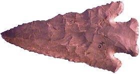
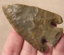
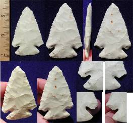
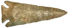
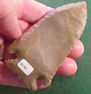
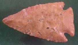
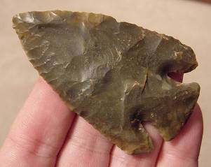
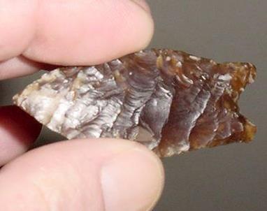
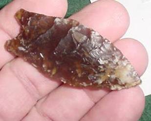
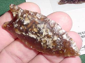
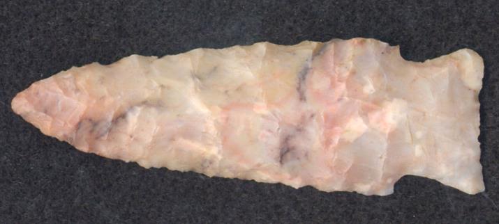
General Description: The Lost Lake is a medium to large sized corner notched point that is beveled on one side of each face. The type is generally large with deep corner notches that often curve in and up from the edge of the blade. The terminal notch scars usually exhibit semicircular Herzian cones. The blade shape varies considerably in the type due to the resharpening processes but is generally triangular. The blade terminates in with rounded barbs which gives the type a distinctive look. The blade shape ranges from excurvate to deeply incurvate. Over the lifespan of a point, the blade shape changed due to the use of bevel reworking techniques, generally becoming less excurvate to straight-edged and then incurvate while continually becoming shorter with each rework episode. Cross sections range from biconvex on blades in pristine condition to rhomboid cross sections on highly reworked examples. Most examples of the type are finely serrated along the blade edges and in general exhibit high quality flaking and a symmetrical outline. The base on this point is usually ground and can be concave, convex, or straight and usually appears to be expanding due to the inward and upward corner notching style.The Lost Lake type is known over much of the southeastern United States with a central focus on Alabama and Tennessee. The distribution range extends into the Ohio Valley and the type is known in Florida, Kentucky, southern Indiana, Ohio, Virginia and West Virginia. The point is called the Bolen Beveled Corner Notched in Florida and also has been known as the Deep Notch in the distribution area. The size range of the Lost Lake point is between 49 mm and 91 mm in length, with the average being 63 mm. The width is between 35 mm and 48 mm wide across the barbs, 7 mm to 8 mm thick with a stem 12 mm to 15 mm long and 23 mm to 32 mm wide across the stem. The point was named by James W. Cambron and David C. Hulse for examples which were recovered from the Lost Lake area of Limestone County, Alabama.
ABOVE: LOSTLAKE01: Lost Lake point; described below
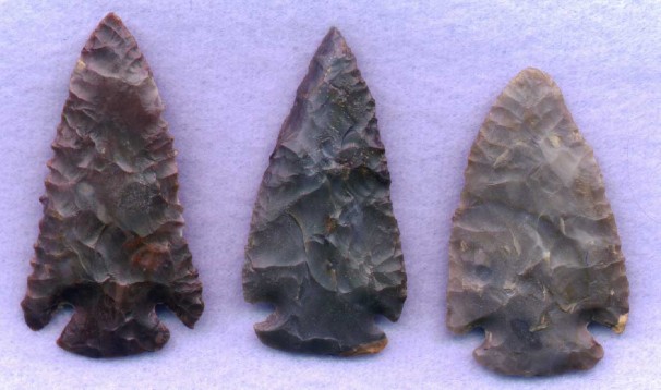
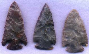
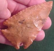
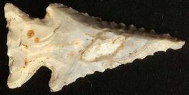
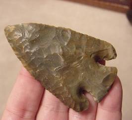
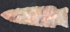
ABOVE: LOSTLAKE02: three Lost Lake points; from L-R: 3.13 inches (78.25mm); 3.0 inches (75mm); 2.75 inches (68.75mm); no locations provided. Nice grouping to see variations in the type LOST LAKE POINT THUMBNAIL GALLERY (386 images: 193 source images/193 thumbnails)
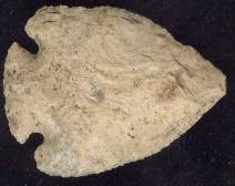
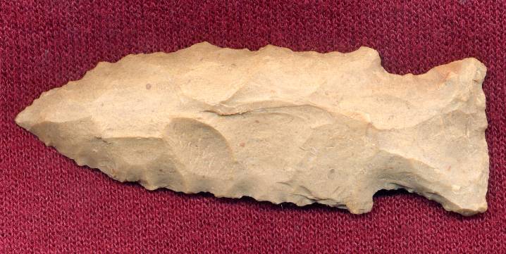
ABOVE: LOSTLAKE03: Lost Lake point; no other details
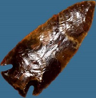
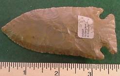
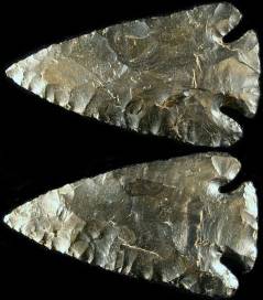
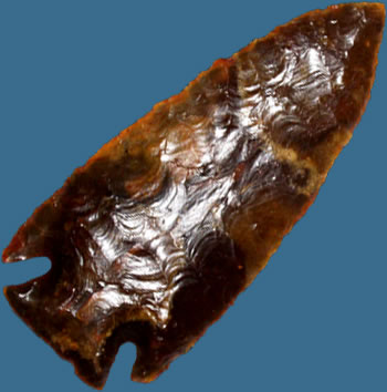
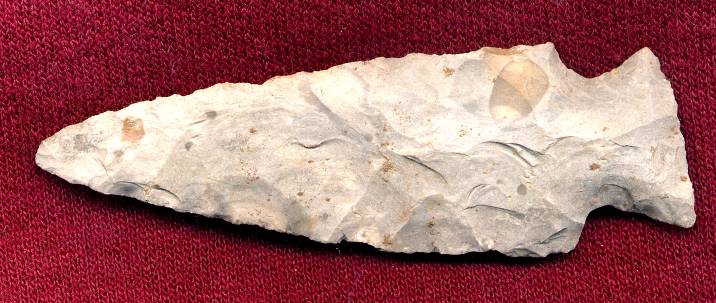
ABOVE: LOSTLAKE04 AND LOSTLAKE05: Lost Lake point; Hart County, Kentucky; 3.06 inches (77.7mm); Sonora chert | ||||||||||||||||||||||||||||||||||||||||
|
Lott Associated Dates: 500 – 300 Y.B.P
|
||||||||||||||||||||||||||||||||||||||||
|
Lovell Associated Dates: 500 – 300 Y.B.P
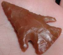
ABOVE: LOVELL01: Lovell point; North Dakota; 2.25 inches (57.1mm); Knife River flint; first of three views
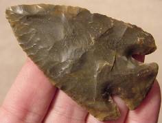
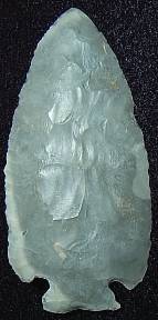
ABOVE: LOWE03: Lowe Flared Base point; Wood Co., West Virginia; 3.0 inches (76.2mm); Flint Ridge flint. Source: Arrowheadsplus dot com |
||||||||||||||||||||||||||||||||||||||||
|
Lowe Flared Base Associated Dates: 1800 – 1400 depending on location
Distribution: “The distribution of Lowe projectile points is mostly limited to the lower Ohio Valley and its tributaries, which include primarily the lower Wabash and Ohio Rivers in southern Illinois, Indiana and northern Kentucky. These points are also found in lower frequency in central Indiana within the White River Valley….and across southern Illinois into the Illinois River Valley….The Lowe Flared Base projectile point spreads through Kentucky….into the Tennessee River Valley.” (Source: Noel D. Justice, “Stone Age Spear and Arrow Points of the Midcontinental and Eastern United States.” Description: Justice describes three different manufacturing strategies for the Lowe Flared Base, Bakers Creek and Steuben Expanded Stemmed points. However, these distinctions are either ignored, unknown, not understood or are disputed by other sources. As a result, identification of any of these three points on Websites and in other locations – including this database – is problematic. Justice however is unequivocal in his assignation of the Lowe Flared Base, Steuben Expanded Stem and Baker’s Creek to separate types: “The Lowe Flared Base type is closely related to Bakers Creek of the Tennessee Valley and represents a stimulus from that region.” LOWE FLARED BASE POINT THUMBNAIL GALLERY (6 images: 3 source images/3 thumbnails)
Lowe Flared Base 1 Lowe Flared Base 2 Lowe Flared Base 3
ABOVE: Lowe Flared Base01: Lowe Flared Base point; North Dakota; 2.25 inches (57.1mm); Knife River flint; first of three views
ABOVE: LOWE02: Lowe Flared Base point; Washington Co., Ohio; 2.8 inches (71.1mm); conglomerate. Source: Arrowheadsplus dot com
ABOVE: LOWE03: Lowe Flared Base point; Wood Co., West Virginia; 3.0 inches (76.2mm); Flint Ridge flint. Source: Arrowheadsplus dot com |
|
©2010 J Keffer |